Skip to main content
Home
Historical Maps
World History
U.S. History
Canadian History
Canada (English)
Canada (Français)
Old School History Maps
Stories on the Map
Armenia
Assyria
Catalonia
Kurdistan
Palestine
Ukraine
Edmaps +
HISTORICAL MAPS OF ASIA
Map Collections and Atlases
Blank and Outline Maps of Asia
(d-maps.com)
Asia Maps: Digital Collections
(Pardee School of Global Studies - Center for the Study of Asia)
Asia Maps Collection
(University of Southern California)
Historical Atlas: Reconnecting Asia
(Center for Strategic and International Studies
Historical Maps of Asia
(University of Alabama)
Historical Maps of Asia
(John C. Huntington)
Atlas of Mutual Heritage
A Historical Atlas of South Asia
(Joseph E. Schwartzberg, ed.)
Historical Maps of South Asia
(Columbia University)
Historical Maps of South Asia (326 B.C. -1856 A.D.)
Historical Maps of South Asia before 1825
(University of Alabama)
Maps for South Asian Studies
(Yale University Library)
Maps
Asia, 1808
(R. Brookes)
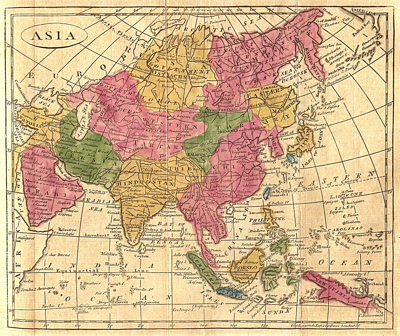
Asia, according to the best authorities, 1814
(M. Carey)
Map of Asia, showing gt. political divisions, and also the various routes of travel between London & India, China & Japan, &c., 1863
(A. Mitchell)
Asia, 1876
(H. L. Kochersperger et al.)
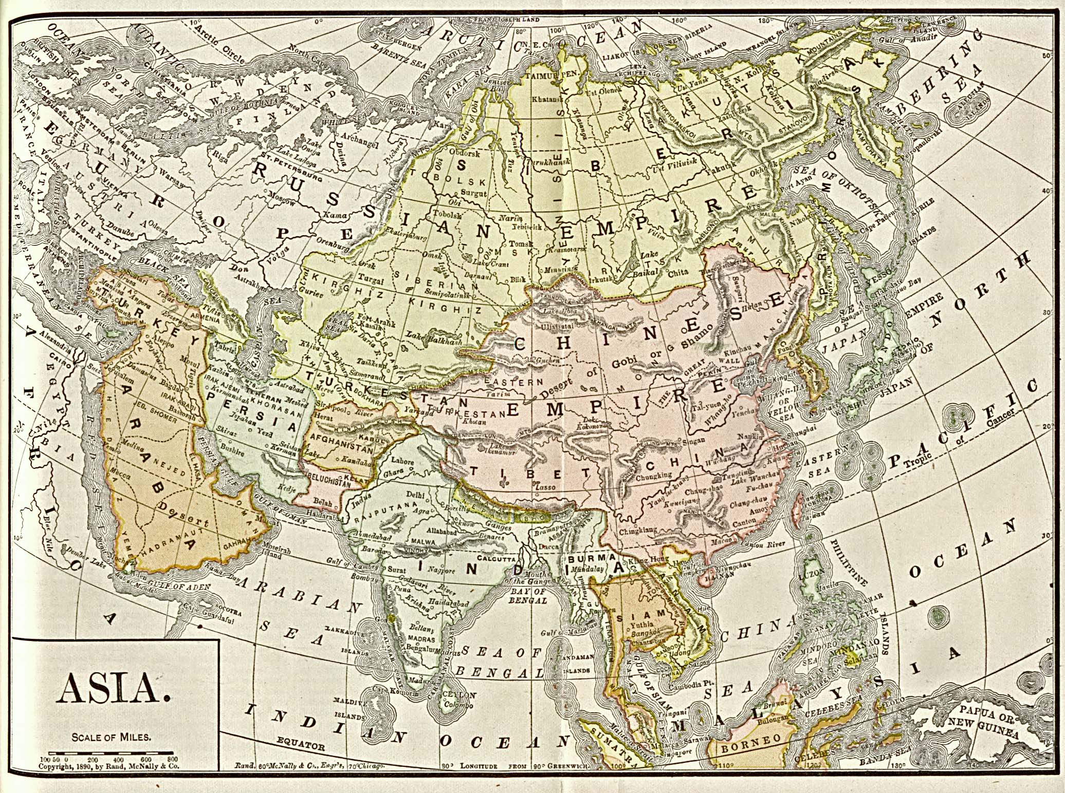
Asia, 1892
(Americanized Encyclopaedia Britannica)
Asia - Political Map, 1920
(J.G. Bartholomew)
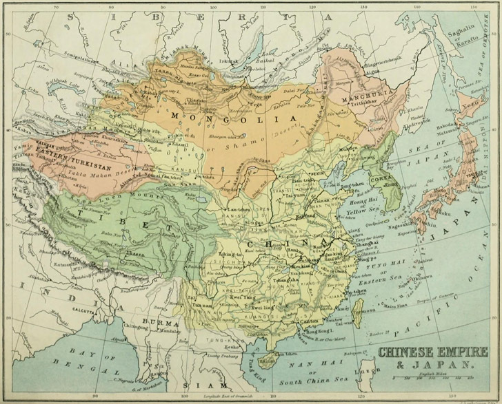
China, Japan & Korea in 1882
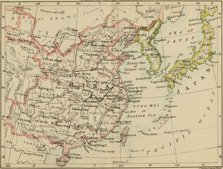
China, Japan & Korea in 1887
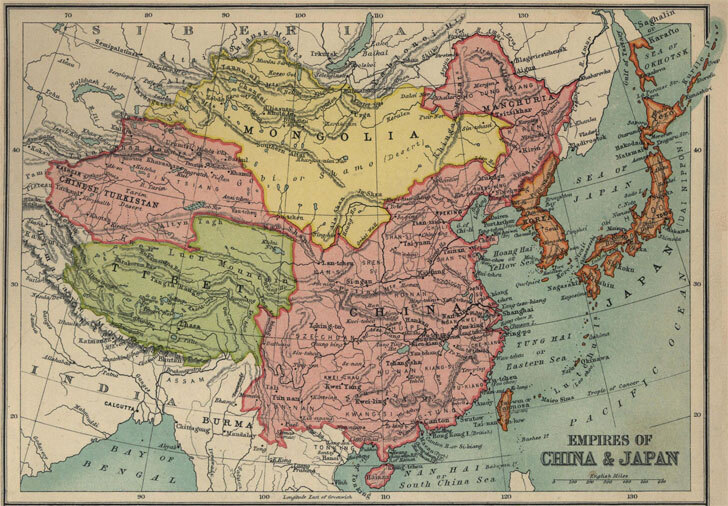
China, Japan & Korea in 1910
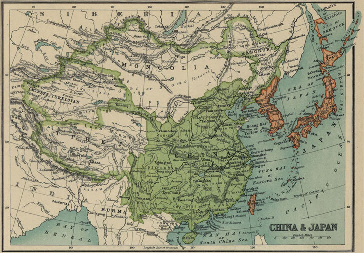
China, Japan & Korea in 1913
Asia
China
India
Japan
Korea
Europe
Latin America
Middle East
Canada
U.S.A.


