Skip to main content
Home
Historical Maps of USA
Historical Maps of Canada
Old School History Maps
EdMaps +
Historical Maps of India
Europe
Middle East
Asia
China
India
Japan
Korea
Latin America
Canada
U.S.A.
Australia
Map Collections and Atlases
A Historical Atlas of South Asia
(Joseph E. Schwartzberg, ed.)
Historical Maps of South Asia
(Columbia University)
Historical Maps of South Asia (326 B.C. -1856 A.D.)
Historical Maps of South Asia before 1825
(University of Alabama)
Maps for South Asian Studies
(Yale University Library)
Blank and Outline Maps of India
(d-maps.com)
Historical Maps of India
Historical Maps of India
(David Rumsey Map Collection)
Historical Maps of India
(Imperial Gazeteer of India)
Historical Maps of the British India
Historical Maps of Indian Towns and Cities (1893-1924)
Historical Maps of the Survey of India (1700-1900)
India: Historical Maps Collection
(Library of Congress)
India: Historical Maps Collection
(Yale University Library Digital Collections)
India Maps
(Perry-Castañeda Library Map Collection)
Partition of India: Map Collection
(Columbia University)
Old Maps of India
(oldmapsonline.org)
Maps
The Mughal Empire, 1526-1761
(britannica.com)
The Mughal Empire, 1556-1707
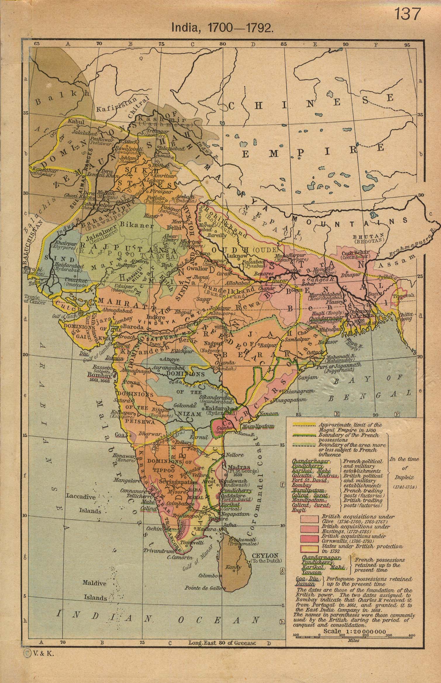
India, 1700-1792
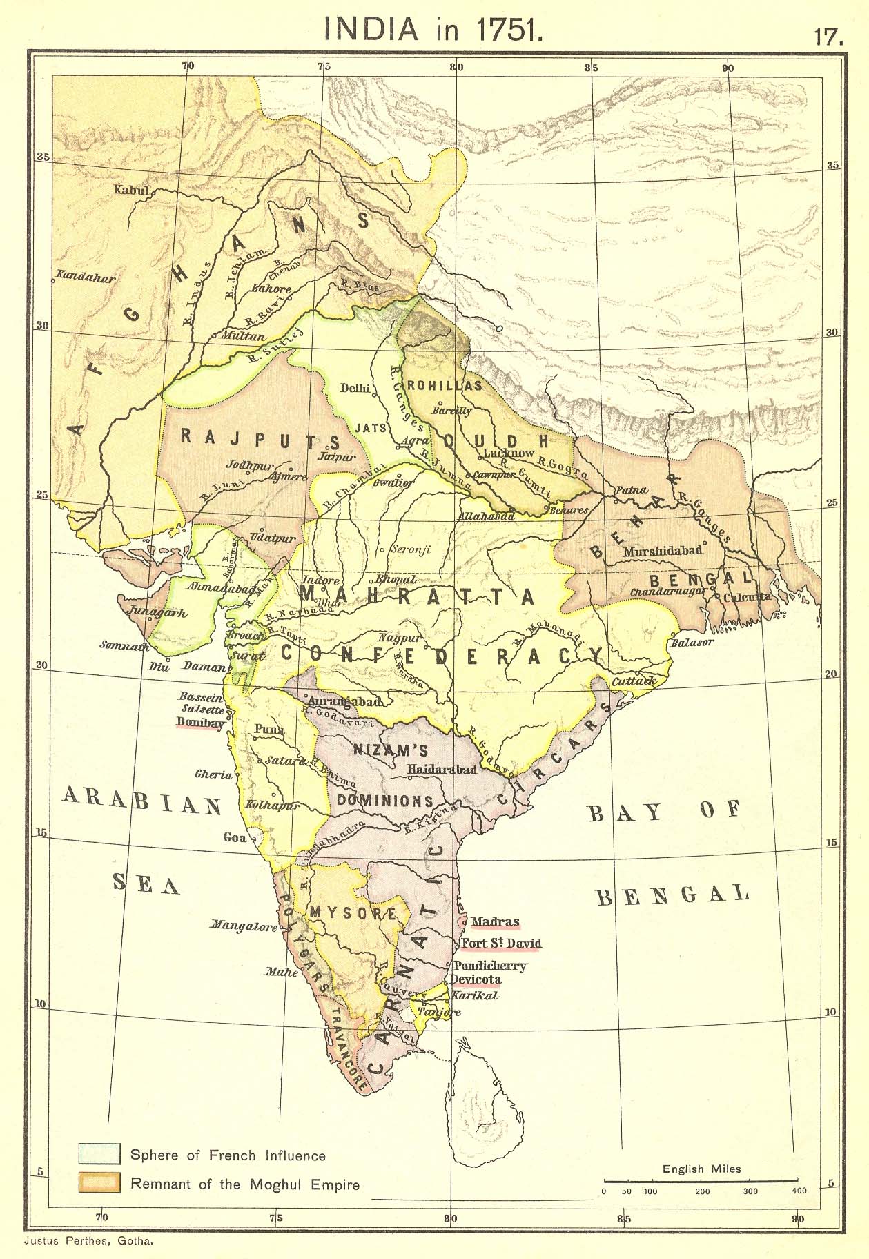
India in 1751
Expansion of the Maratha Empire, 1758
India in 1785
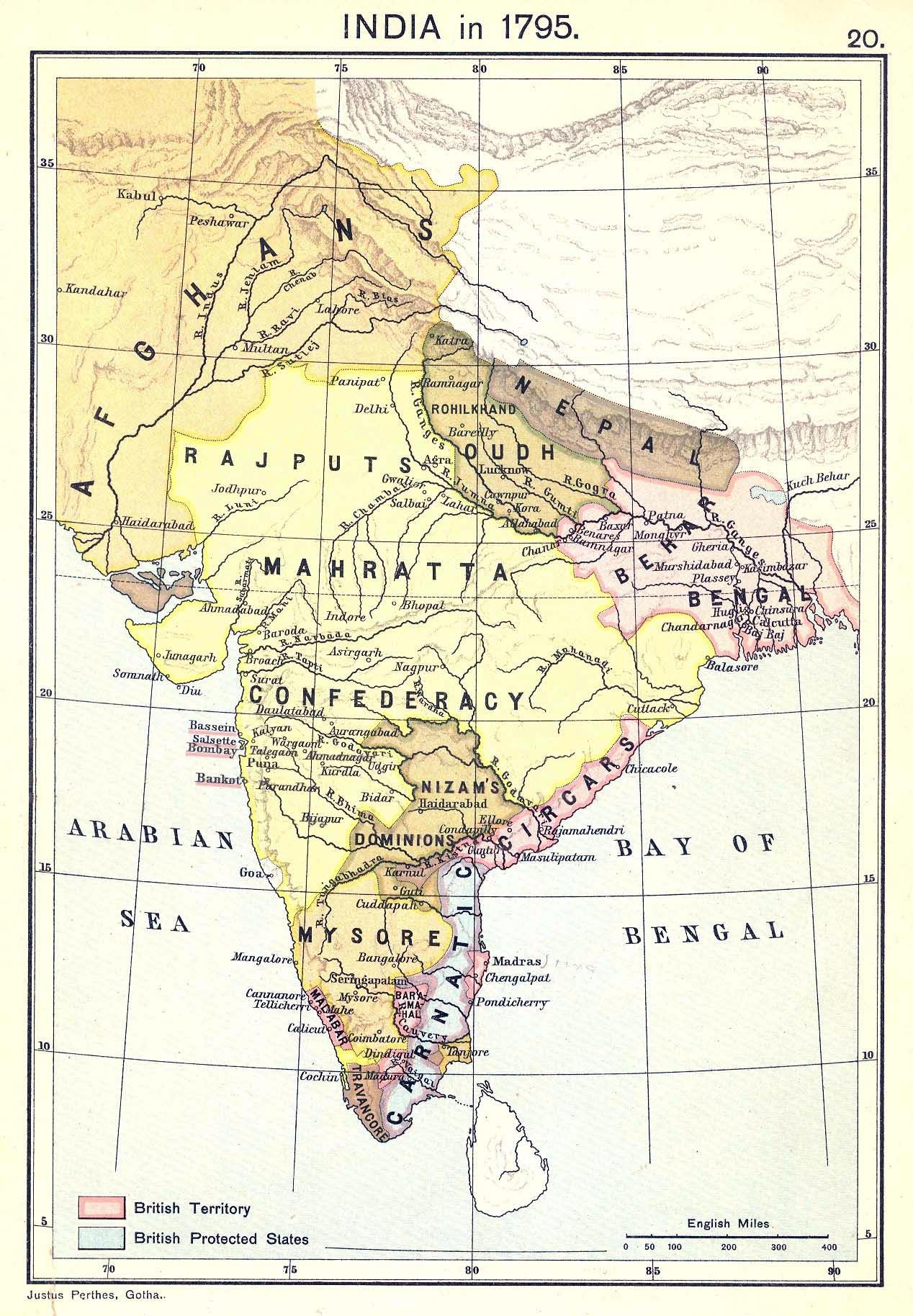
India in 1795
India in 1804
India in 1823
India, 1832
(John Dower)
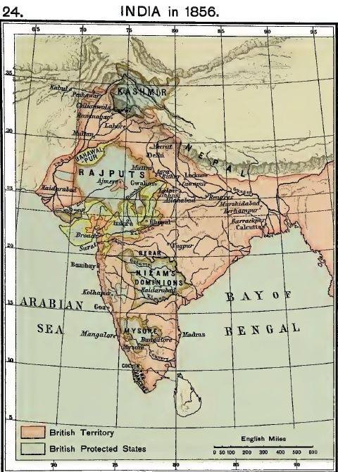
India in 1856
Military Map of the Indian Empire, 1893
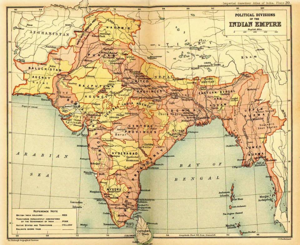
Political Divisions of the Indian Empire
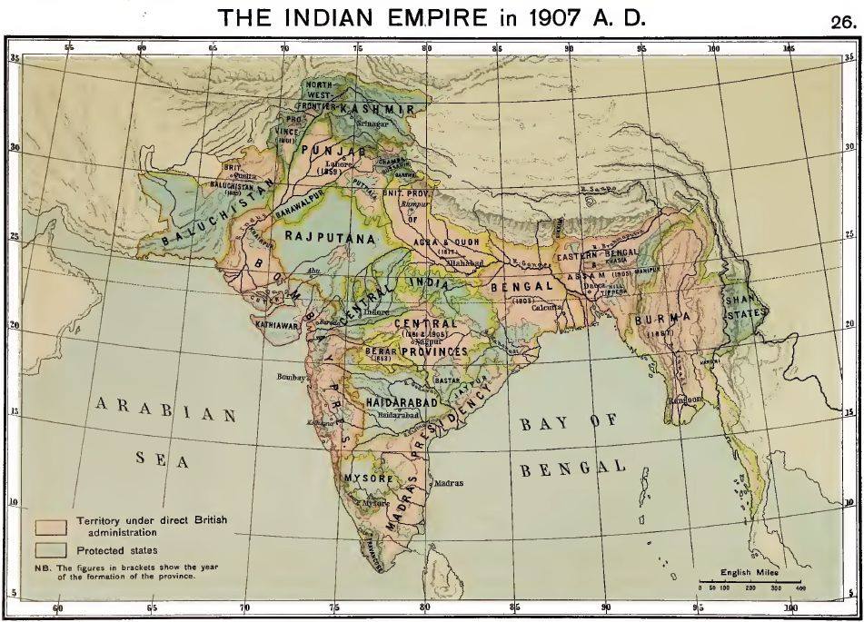
The Indian Empire in 1907
The Indian Empire and the Surrounding Countries in 1909
Indes anglaises, 1943
(Girard & Barrère)
India Around Independence
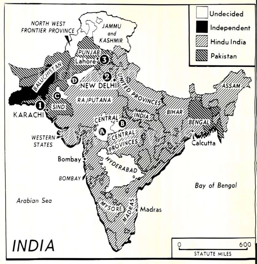
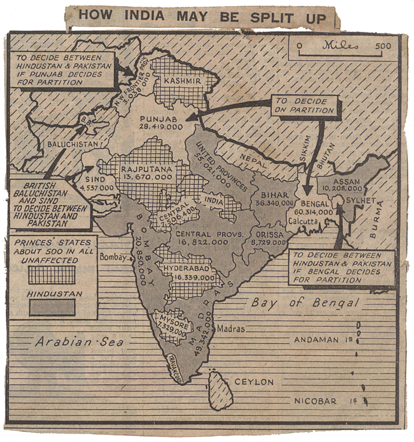
How India May Be Split Up
(U. K. National Archives)
Pre-Partition Map of India - Before 1947
(mapsofindia.com)
The United Punjab before Partition showing the national boundary under the Partition Plan of 3rd June 1947
‘New Political Map’ of Pakistan, 2020
(dawn.com)

